

Cambodia
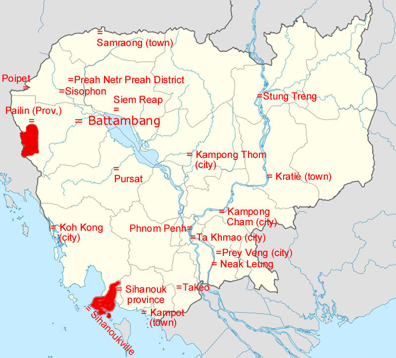
With a population of over 14.8 million, Cambodia is the 70th most populous country in the world. The official religion is Theravada Buddhism, which is practiced by approximately 95% of the Cambodian population. The country's minority groups include Vietnamese, Chinese,
Chams and 30 hill tribes.[8] The capital and largest city is Phnom Penh, the political, economic, and cultural center of Cambodia. The kingdom is a constitutional monarchy with Norodom Sihamoni, a monarch chosen by the Royal Throne Council, as head of state. The head of government is Hun Sen, who is currently the longest serving leader in South East Asia and has ruled Cambodia for over 25 years.
 2. Battambang population: 196,000
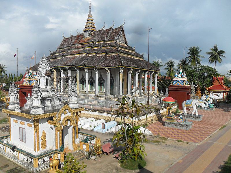
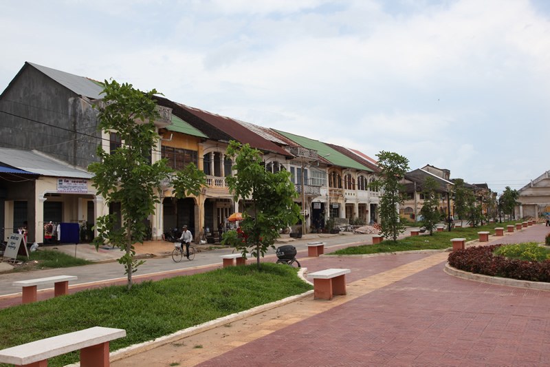
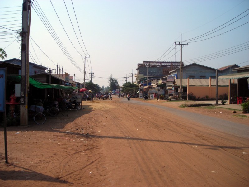
Battambang (Khmer: ក្រុងបាត់ដំបង, "Batdambong"; Thai: พระตะบอง, RTGS: Phra Tabong) is the capital city of Battambang province in northwestern Cambodia. Founded in the 11th century by the Khmer Empire, Battambang is well known for being the leading rice-producing province of the country. For nearly 100 years, it was a major commercial hub and provincial capital of Siamese province of Inner Cambodia (1795-1907), though it was always populated by Khmer with a mix of ethnic Vietnamese, Lao, Thai and Chinese. Still today Battambang is the main hub of the Northwest connecting the entire region with Phnom Penh and Thailand, and as such it’s a vital link to Cambodia.
The city is situated by the Sangkae River, a tranquil, small body of water that winds its way through Battambang Province providing its nice picturesque setting. As with much of Cambodia, the French Colonial architecture is an attractive bonus of the city. It is home to some of the best preserved French colonial architecture in the country.
 6. Kampong Cham population: 58,900
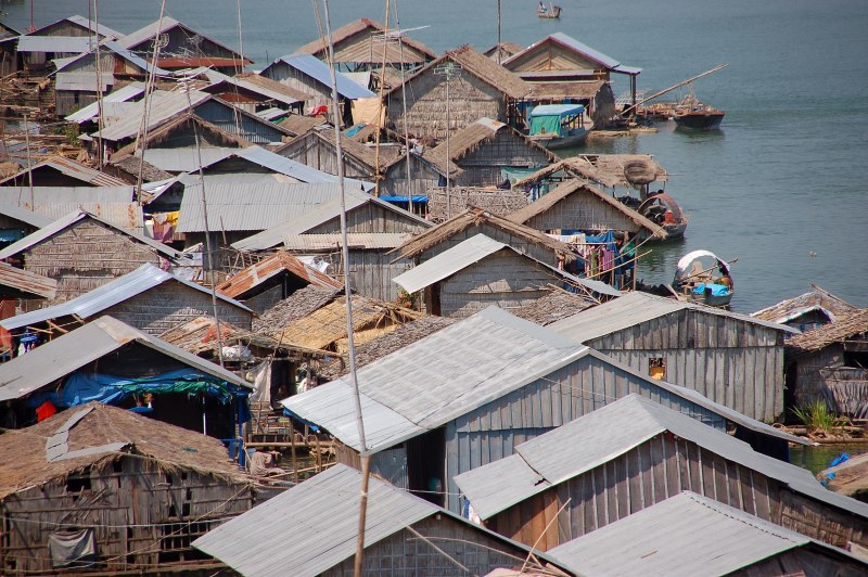
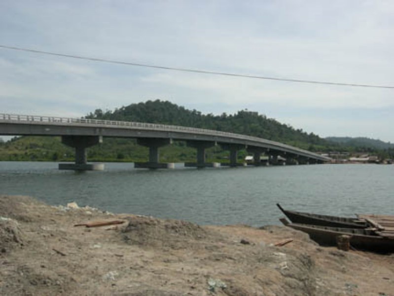
Kampong Cham (city) Floating village in Kampong Cham. Kampong Cham (Khmer: ក្រុងកំពង់ចាម) is the capital city of the Kampong Cham Province in eastern Cambodia. It is the third largest city in Cambodia[2] with a population of 63,771 people (2006)[3] and is located on the Mekong River. Kampong Cham is 124 kilometers northeast from Phnom Penh and can be reached by either boat or by asphalt road. It takes about 2.5 hours by vehicle or 2.5 hours by boat from Phnom Penh to the city of Kampong Cham. Its geographic location is 12.00°N, 105.46°E. The city is connected to the district of Tbong khmum by the Kizuna bridge, the first in Cambodia to span the Mekong. The city is subdivided into four khums and 31 phums.
Kampong means "the side of a river or any other water body" with Cham meaning Cham ethnicity of Champa. A similar Malay word "Kampung" means "village."
 4. Sihanoukville population: 94,500
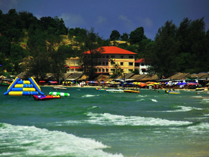
Sihanoukville (Khmer: ក្រុងព្រះសីហនុ - Krong Preah Sihanouk), also known as Kampong Saom, is a province (khaet) of Cambodia on the Gulf of Thailand. This port city is a growing Cambodian urban center, located 185 kilometres (115 mi) southwest of the Cambodian capital, Phnom Penh. The province is named after King Father Norodom Sihanouk and grew up around the construction of Sihanoukville Port. Construction on the port began in June 1955 and it was the only deep water port in Cambodia.[2] The port was built in part due to the waning power of the French leading to the Vietnamese tightening their control over the Mekong Delta and hence restricting river access to Cambodia. Sihanoukville's beaches have made it a popular tourist destination.[3] The province is served by Sihanoukville International Airport, 18 kilometres (11 mi) from downtown, although it has a limited commercial operation. The airport currently has limited passenger flight between Siem Reap and Phnom Penh on Cambodia Angkor Airlines. Sihanoukville attracts tourists with its relaxed beach atmosphere when compared to Thailand's more developed ones. However, the city has attracted not only tourists, but several NGOs and foreign and national investors in the last years in order to develop not only the growing tourist industry, but its capacity as an international sea port[4] and other sectors like textile and real estate.[5] In Sihanoukville is also located the main factory of Angkor Beer, the Cambodian national beer.
Sihanoukville was the place of the last official battle of the United States army in the Vietnam War, although the incident took place outside Vietnam. It is known as the Mayaguez incident on May 12–15, 1975 between the US forces and the Khmer Rouge. Currently, visitors dive in Koh Tang, one of the Sihanoukville islands where the major battle to free the SS Mayagüez took place. Divers can see two shipwrecks 40 metres (130 ft) down.[6] On 22 December 2008, King Norodom Sihamoni signed a Royal Decree that changed the municipalities of Kep, Pailin and Sihanoukville into provinces, as well as adjusting several provincial borders.[7]
 Kampong Thom (city)Kampong Thom (Khmer: ក្រុងកំពង់ធំ, "Grand Port") is the capital city of Kampong Thom Province, Cambodia lying on the bank of the Stung Sen River. It is served by the national highway, going from Siem Reap to Phnom Penh.
 Kampot (Khmer: ក្រុងកំពត, "Tetraodontidae") is the capital of Kampot Province in southern Cambodia. The city is a quiet riverside town just a few kilometers from the Gulf of Thailand. Kampot was best known for its famous black pepper, which is still widely available in Cambodia. The fresh climate and soil type of Kampot as well as the experience from several generations of pepper farmers make this pepper unique and much sought-after by gourmets worldwide. It is also famous for its Kampot fish sauce.
 Koh Kong (Khmer: ក្រុងកោះកុង, Thai: เกาะกง; RTGS: Ko Kong) (transliterated as Krong Koh Kong) is the capital of Koh Kong Province in Cambodia. It is located near the mouth of the Kah Bpow river in Smach Mean Chey district on the Gulf of Thailand. The city lies only 10 kilometres from the Thai border. However, it is 138 kilometres by Highway 48 to National Highway 4 at Sre Ambel and a further 133 kilometres to Phnom Penh.[2] After the completion of the bridges on the Highway 48 in 2007 - 2010 the terrestrial link to Phnom Penh and Sihanoukville has significantly improved.
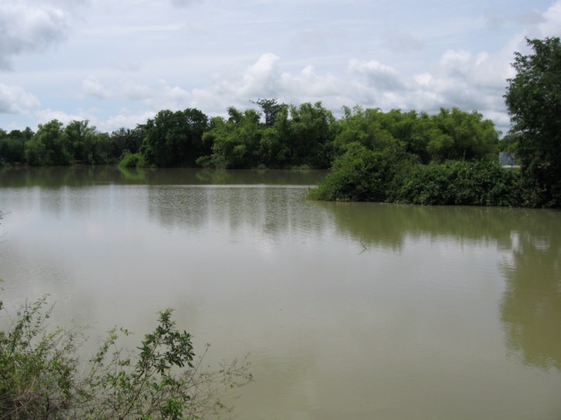
 Kratié is the capital of Kratié Province in eastern Cambodia. The small town has a population of about 13,000 and lies on the banks of the Mekong River. The city is dominated by a central marketplace surrounded by old, French colonial buildings. Along the river red-flower trees grows in rows along the riverbank. The picturesque town contains big islands with white sand beaches out front that bends in the river. The stretch of river north of the city is home to a group of rare Irrawaddy dolphins. The dolphins are the town's main tourist attraction. A survey conducted in 2007 by Cambodian Mekong Dolphin Conservation Project (CMDCP), a collaborative project between WWF, World Conservation Society, Fisheries Administration and Cambodian Rural Development Team (CRDT), estimated that there are between 66 and 86 dolphins left in the upper Cambodian Mekong area.[2]
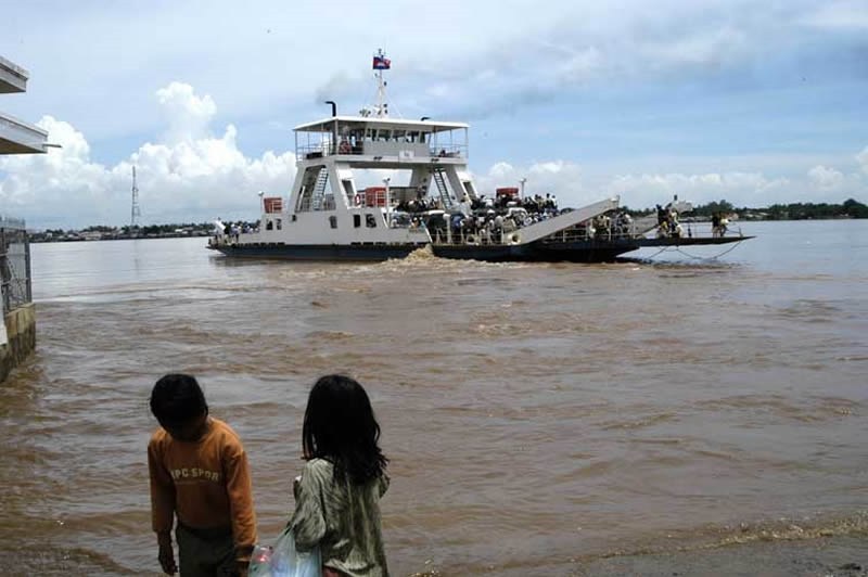 Neak Leung (Khmer:) is a busy commercial town in Prey Veng Province, Cambodia. Located on the Mekong and astride National Highway number 1, it is the commune centre for Neak Leung commune and the capital of Peam Ror District. The town can be reached by car ferry from Kampong Phnum in Kandal Province or by boat along the Mekong river. Due to its strategic location, the town and port of Neak Leung has been a significant battleground at various times in Cambodia's history. In August 1973, during the Cambodian Civil War, Neak Leung was propelled to the centre of international attention when an American B-52 Stratofortress mistakenly dropped its 20 ton load on the town centre.[2]
 Pailin (Khmer; Thai: ไพลิน, RTGS: Phailin; Thai pronunciation: [pʰāj.lin]; "Gem") is a province (khaet) in western Cambodia at the northern edge of the Cardamom Mountains near the border of Thailand. This province is surrounded by Battambang Province, and was officially carved out of Battambang to become a separate administrative division after the surrender of the Ieng Sary faction of the Khmer Rouge in 1996. Pailin is known to much of the world for having long been a stronghold of the Khmer Rouge, remaining under their control long after they were defeated in 1979 and serving from 1994-1998 as the capital of the "Provisional Government of National Union and National Salvation of Cambodia." On 22 December 2008, King Norodom Sihamoni signed a Royal Decree that changed the municipalities of Kep, Pailin and Sihanoukville into provinces, as well as adjusting several provincial borders.[2][3]
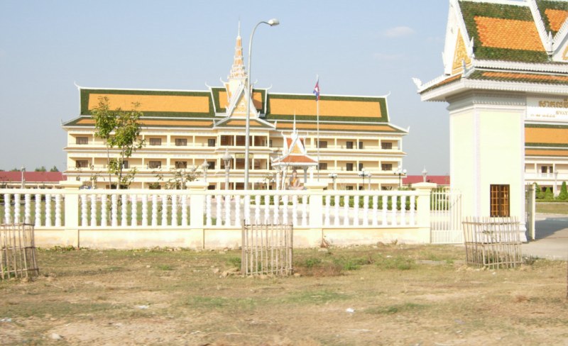
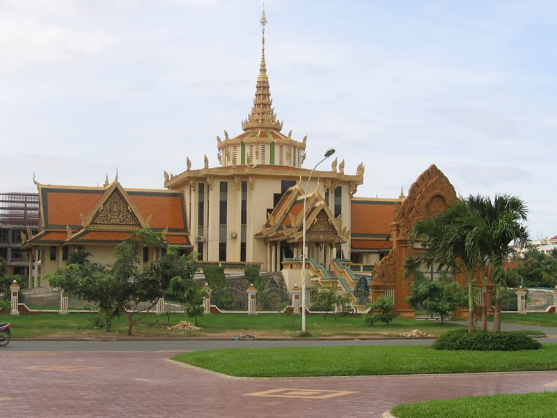 1 Phnom Penh population: 1,325,681 (/pəˈnɒm ˈpɛn/ or /ˈnɒm ˈpɛn/; Khmer:, Khmer pronunciation: [pnum pɨɲ]) is the capital and largest city of Cambodia. Located on the banks of the Mekong River, Phnom Penh has been the national capital since French colonization of Cambodia, and has grown to become the nation's center of economic and industrial activities, as well as the center of security, politics, cultural heritage, and diplomacy of Cambodia. Once known as the "Pearl of Asia," it was considered one of the loveliest French-built cities in Indochina[3] in the 1920s. Phnom Penh, along with Siem Reap and Sihanoukville, are significant global and domestic tourist destinations for Cambodia. Founded in 1434, the city is noted for its beautiful and historical architecture and attractions. There are a number of surviving French colonial buildings scattered along the grand boulevards. Situated on the banks of the Tonlé Sap, Mekong and Bassac rivers, the Phnom Penh metropolitan area is home to about 2.2 million[2] of Cambodia's population of over 14.8 million, up from about 1.9 million in 2008.[4] The city is the wealthiest and most populous city in Cambodia and is the country's political hub.
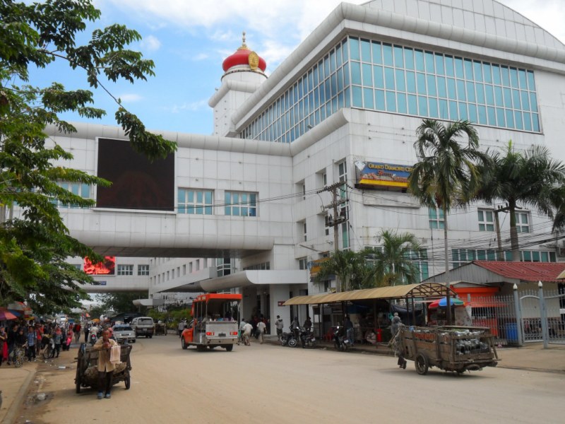 Poipet (also Poiphet, properly Paoy Paet) is a Cambodian town on the Cambodia/Thailand border, in Ou Chrov district, Banteay Meanchey Province. It is a key crossing point between the two countries, and also extremely popular as a gambling destination as gambling is popular, but illegal in Thailand. There is a strip of casinos and hotels between the Cambodian and Thai passport control counters, enabling Thais to gamble in Cambodia without needing to go through Cambodian immigration. This casino strip area is a 'special zone' that prevents Cambodians from gambling. There is another border on the Cambodian side of this strip area that one needs to pass before being free to travel within the rest of the country. Poipet is adjacent to the town of Aranya Pratet on the Thai side of the border. Its population has increased from 43,366 in 1998 census to 89,549 in 2008 census, making it the 4th most populous settlement in Cambodia just ahead of Sihanoukville and bigger than its provincial capital Sisophon.[1]
 8 Pursat population: 46,000 Pursat is the capital of Pursat Province, Cambodia. Its name derived from a type of tree.[2] It lies on the Stung Pouthisat River.
http://en.wikipedia.org/wiki/Preah_Net_Preah
Preah Netr Preah District
Preah Netr Preah (Khmer: ស្រុកព្រះនេត្រព្រះ, "Eyes of the Lord") is a district (srok) in the east of Banteay Meanchey Province, in north-western Cambodia. The district capital is Preah Netr Preah town located around 24 kilometres due east of the provincial capital of Sisophon by road. Preah Netr Preah District is one of the eastern-most districts of Banteay Meanchey. The district shares a border with both Siem Reap Province and Battambang Province to the east and the south respectively. Two major watercourses, the Sangke River and the Mongkol Borei River run through the district.[2] The district is easily accessed by road from Sisophon (24 km) and Siem Reap (city) (78 km). Preah Netr Preah is one of the largest districts in Banteay Meanchey province by land area and only Thma Pouk District is larger. National Highway 6 which begins in Skun town Kampong Cham Province and ends at Sisophon bisects the district running from east to west. Various smaller roads connect the district with Phnom Srok District and Mongkol Borei District.[3]
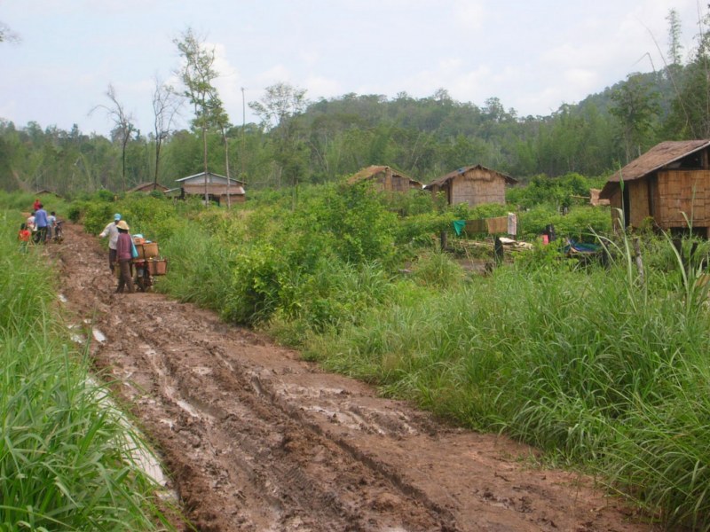
 Samraong (Khmer:, "impenetrable jungle") is the capital of Oddar Meancheay Province in northwestern Cambodia. Samraong is reemerging very slowly compared to other cities from decades of isolation, which was caused by a long civil war. The dusty town has poor infrastructure and basic guesthouses located near the central market. To the north of the town is the border crossing of O'Smach into Thailand
 http://en.wikipedia.org/wiki/Siem_Reap
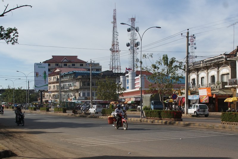
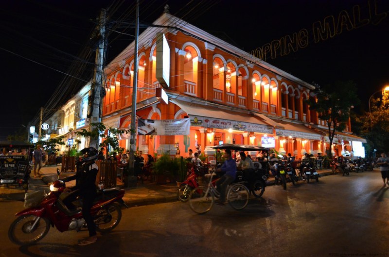
3 Siem Reap population: 148,000 Siem Reap (Khmer: ; Thai: , RTGS: Siemmarat) is the capital city of Siem Reap Province in northwestern Cambodia, and is the gateway to Angkor region. Siem Reap has colonial and Chinese-style architecture in the Old French Quarter, and around the Old Market. In the city, there are traditional Apsara dance performances, craft shops, silk farms, rice-paddy countryside, fishing villages and a bird sanctuary near the Tonle Sap Lake.
Siem Reap today, being a popular tourist destination, has a large number of hotels and restaurants.
http://en.wikipedia.org/wiki/Prey_Veng_%28city%29
5 Prey Veng population: 73,300
Prey Veng (city)Prey Veng (Khmer: ក្រុងព្រៃវែង) is the capital of Prey Veng Province in southern Cambodia.
The town is located on the National Road 11 between Nak Loeung and Kampong Cham. It is located about two and half hours by road from Phnom Penh and three hours from Ho Chi Minh City. This quaint town is off the usual tourist trail and is uncrowded. It houses several old dilapidated colonial homes. There is a large lake west of the city which is dry from March to August.
 Serei Saophoan (properly Svay Sisophon, Khmer: សិរីសោភ័ណ; Thai: ศรีโสภณ, RTGS: Si Sophon) is the provincial capital of Banteay Meanchey, Cambodia. The city separates Cambodia's National Highway 5 and National Highway 6. Serei Saophoan is difficult to pronounce, so often the area is written transliterated as "Sisophon", even on Cambodian signs. Its population is 61,482 in the 1998 census, changing little to 61,631 in the 2008 census having been overtaken by Poipet in size.[2] About forty minutes from Sisophon there is a Khmer temple ruin called Banteay Chmar.
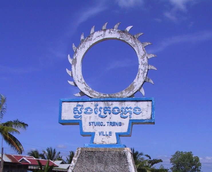 Stung Treng (Khmer:) is the capital of Stung Treng Province, Cambodia. It is located in the western part of the Virachey National Park.[1] It is the major city (and capital) of both the district and province and has a population of 29,665 (2009). In Lao, the city's name is known as Xieng Teng. Stung Treng is located on a high sandy bank overlooking the Mekong River, where it is joined by the Se Kong river. It lies along the National Highway 7,[2][3] about 400 km from Phnom Penh and 50 km south of the Laos border. A bridge connects the city to the other side of the river. The population is made up of a mix of Khmer and Lao peoples. It contains a hospital, the Acleda Bank, Kong Ratana Sambath Guesthouse, Ou Dynak Red Guesthouse, Sok Sambath Hotel and Sorya Restaurant and an old settlement nearby called Thala Borivat.[1]The city is served by Stung Treng Airport, but currently there are no regular commercial services.
 Svay Rieng is the capital city of Svay Rieng Province, Cambodia. The city is subdivided into 4 khums and 18 phums. It contains the Svay Rieng University.
http://en.wikipedia.org/wiki/Ta_Khmau Ta Khmao (Khme, literally: "Black Grandfather") is the capital of Kandal Province in central Cambodia. The city is about 11 km (7 Miles) south of Phnom Penh (directly borders of Phnom Penh). The City is subdivided into 6 communes (Sangkat) and 20 villages (Phum).[2]Approximately 60% of the citizens of Ta Khmao travel to work in Phnom Penh.
 10. Takéo population: 28,300
Takéo is the capital of Takéo Province, Cambodia. As of 1998 it had a population of 39,186. The town and province is known for its silk weaving and the province is home to about 10,000 of the total of 15,000 Cambodian weavers. Most silk weavers in the villages are near the national highway in the direction of Takeo town. The technique of silk weaving could have come to the Khmer during the Funan Empire, probably in the 2nd century, from India and China.[citation needed]
http://www.wajah.asia/index.php?id=cambodia
![]()
 Previous
 LATEST IMAGE

RANDOM IMAGE

WAJAHASIA APP
LOGIN
Reset password
Click here to register
Online: 197 Guests, 0 Users
HITCOUNTER